
Our Services


Subsurface Utility Mapping (SUM)
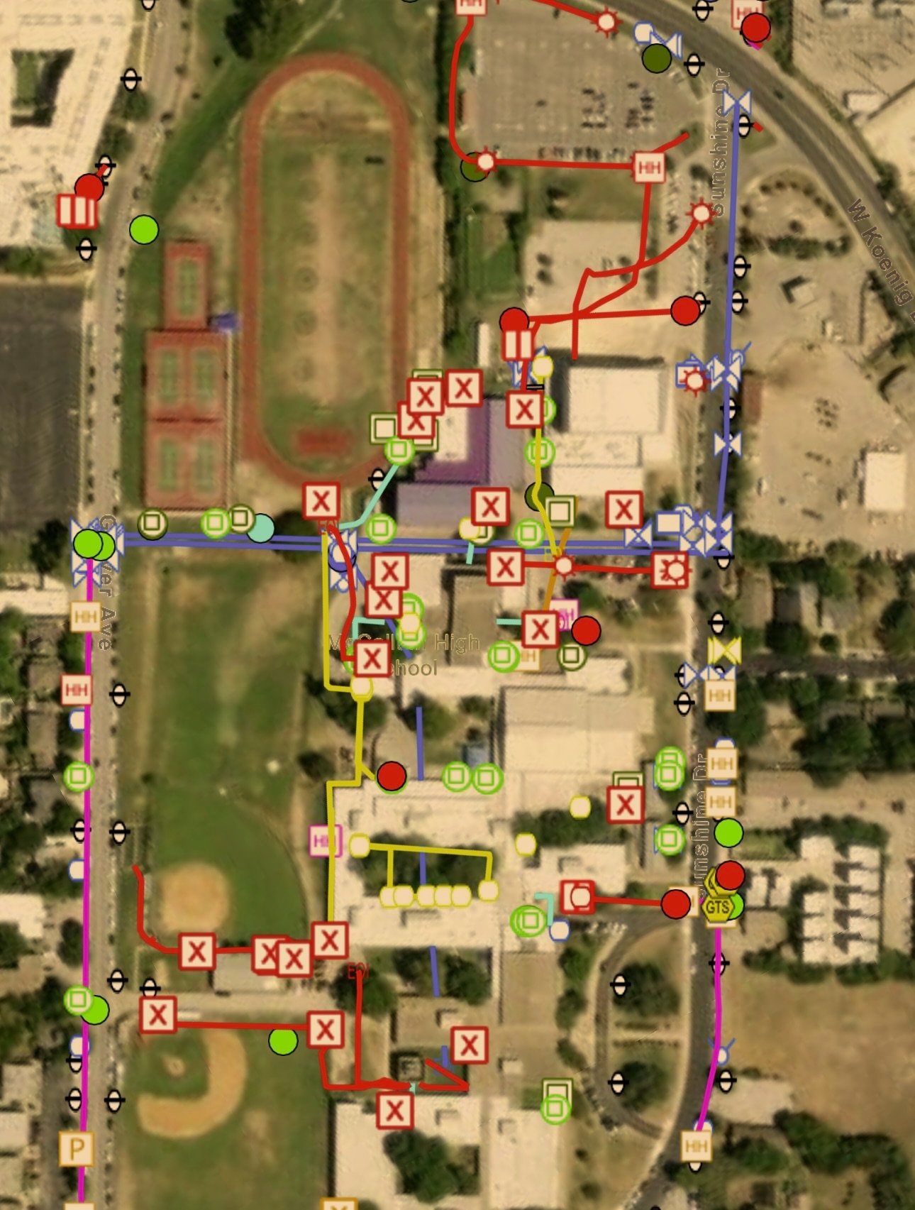
Our Subsurface Utility Mapping (SUM) service delivers precise identification and documentation of underground utilities using advanced technologies and customized solutions to meet your project’s unique requirements. With a focus on accuracy and flexibility, we provide the critical data needed for informed decision-making and efficient planning.
Data Collection Processes
Our data collection methods include:
Ground-Penetrating Radar (GPR): Non-invasive imaging to locate buried utilities and subsurface features.
Electromagnetic (EM) Surveys: Effective detection of conductive utilities like pipes and cables.
Geospatial and GPS Tools: High-precision location data for seamless integration into mapping platforms.
Utility Verification: Cross-referencing as-built drawings and utility prints to verify existing utility networks.
Test Holing: Minimally invasive excavation to verify the exact location and depth of utilities.
Field Markings and Work Zone Documentation
To ensure clarity and accessibility on-site, we provide:
Ground Markings: Paint and flags to indicate utility locations for easy identification.
Work Zone Photos: Comprehensive visual documentation of the area, uploaded to the GIS platform for seamless access and record-keeping.
Utility Documentation
All collected data is meticulously documented in a Geographic Information System (GIS), creating a centralized and easily accessible database. For clients requiring enhanced detail, survey data can be drafted into 2D or 3D deliverables tailored to specific project needs.
Above-Ground Utility Documentation
For a complete utility network overview, we offer above-ground documentation services, which include:
Utility Pole to Pole Mapping: Capturing connections between poles for accurate representation.
Utility Pole to Building/Facility Mapping: Documenting connections from poles to structures.
Levels of Detail:
Basic Documentation: Top-to-bottom mapping with a digital representation of the network.
Advanced Documentation: Includes spacing between lines, riser locations, and connections to the first structure.
Flexible Deliverables
We offer customizable outputs to meet your needs, including:
Digital maps integrated into GIS platforms for easy access and analysis.
Drafted 2D or 3D* CAD models for enhanced visualization and project coordination.
By combining advanced technology, utility verification, field markings, and detailed documentation, our SUM services provide the actionable insights needed for successful project execution. Subsurface utility engineering can also be offered if requested by the client.
